Geodetic Project Course 2015
From the 8th to the 26th of June 2015, sixteen geomatics students joined the Geodetic Project Course, which took place in Engadin (Graubünden). They had to carry out three full-size projects whose measurement campaigns took place in Santa Maria, at the Punt dal Gall dam, and in the vicinity of Ftan. The course base was located in Zernez.
Concerning the Santa Maria project, a 3D model of the remains of a church built around 1228 was generated. Two different measurement techniques such as laser scanning and photogrammetry were employed and compared. 18 scans were acquired with a Faro Focus3D laser scanner, delivering a final model consisting of 50 million points. Regarding photogrammetry, both terrestrial and airborne acquisitions were performed; the input data of the former method consist in pictures taken from the ground, while the images used for the latter method were acquired by an Unmanned Aerial Vehicle (UAV). The two obtained photogrammetric models feature 11.2 and 8.5 million points, respectively.
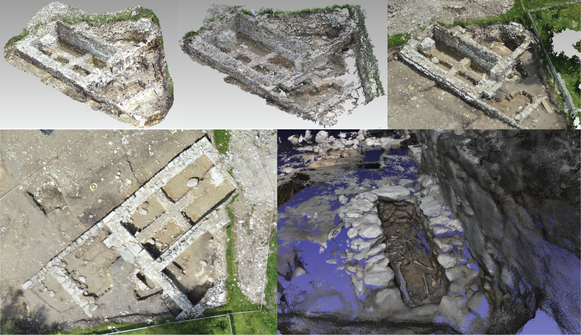
The results show that all measurement methods deliver satisfactory results and that the laser scanner delivers the most accurate and complete model. However, terrestrial photogrammetry offers a valuable alternative when a compromise between accuracy, completeness and costs is sought.
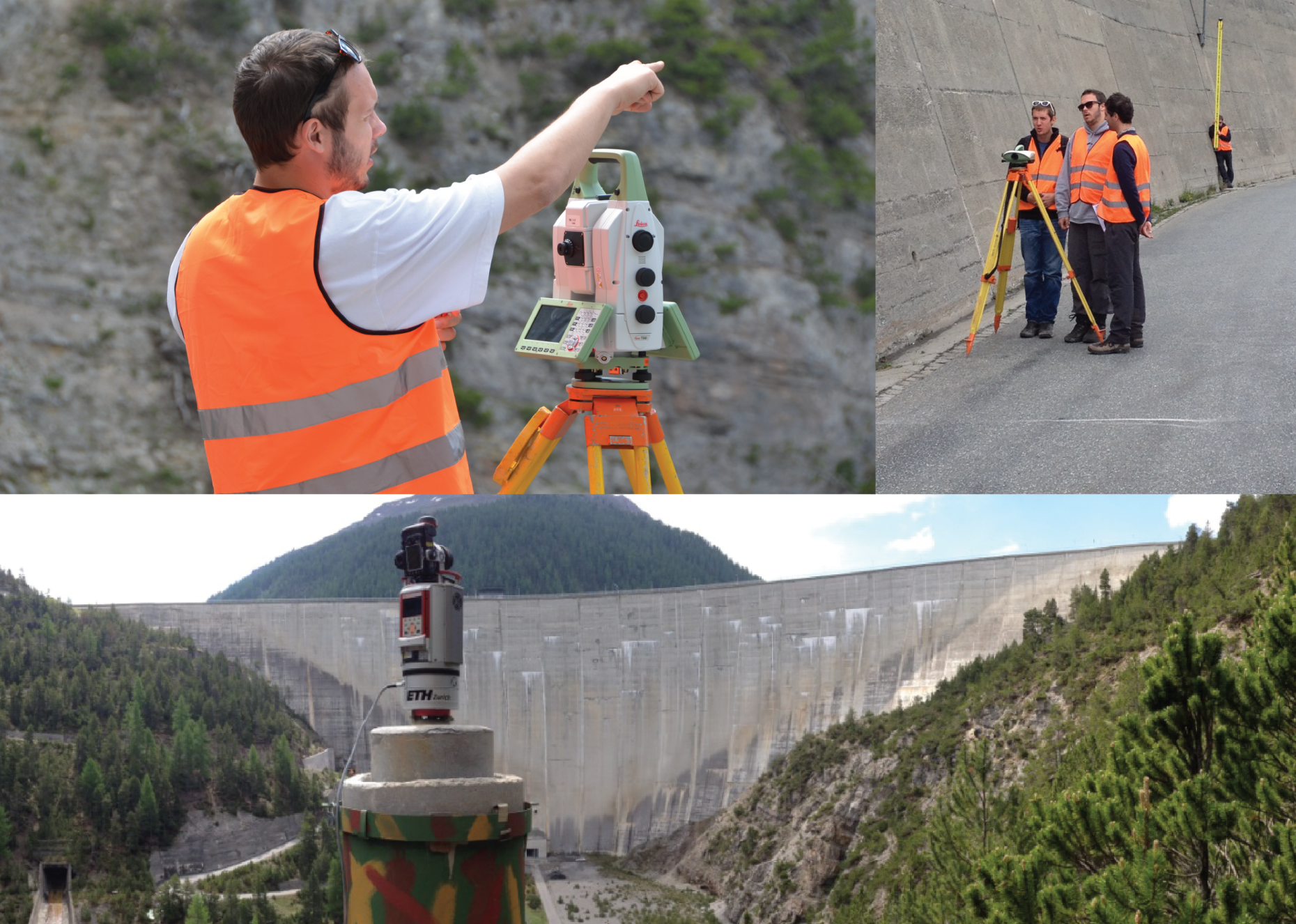
The project conducted at the Punt dal Gall dam consisted in replicating the periodical monitoring campaign. Additionally, the potential of detecting displacement of the dam wall with a terrestrial laser scanner was investigated. The first task was relatively straightforward - two levellings were executed on the dam crest and a trigonometric geodetic network was set on the existing monitoring pillars. The results of the total station measurements showed that all monitored points were stable. The leveling showed that some of the observed points had moved slightly between the measurements epochs. Therefore, the leveling was carried out a thrid time to double check the results. The movement could be explained by an ongoing road construction occurring next to those points. Similarly, also the laser scans showed no significant displacements, meaning that water level increase of 3 m between the scans did not cause enough deformation to be detected with the deployed long-range laser scanner.
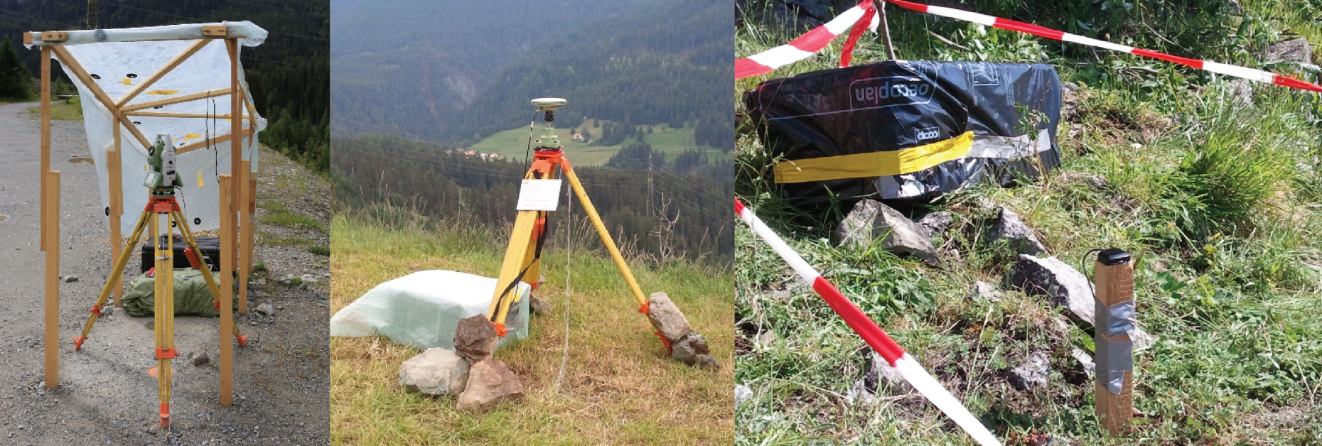
The third group worked near Ftan, designing and installing a landslide monitoring system which remained active for two weeks. GNSS sensors and a total station were deployed in the area of interest. The total station measured a set of prisms with a period of 3 hours, whereas the GNSS sensors were acquiring data continuously. The obtained results were summarized in report addressed to the local authorities, providing them some useful recommendations about the features that a potential future monitoring system should include.